The climate and resources of the Kapiti Coast have attracted people for many centuries. Traditions hold that Kapiti Island was sliced from the mainland by the great Polynesian explorer Kupe. Following permanent settlement in Aotearoa, the rangatira Tara, son of Whātonga of the Kurahaupō waka, settled at what came to be known as Te Whanganui-a-Tara (Wellington harbour) and around the region. Descendants of his brother Tautoki, known as Rangitāne, settled in Kapiti, the Manawatū and Wairarapa. In time, groups now known as Muaūpoko and Ngāti Apa also emerged and settled in the district, and were closely allied with their Rangitāne kin. Ngāti Rangi hapū are said to have occupied the area around Paekākāriki and Paraparaumu. In the seventeenth century Ngāti Ira of Hawke’s Bay arrived in the region and extensive intermarriage occurred. Other iwi who made a home in the region included Ngāti Kahungunu, Ngāi Tahu, and Ngāti Māmoe.
Nineteenth century arrivals in the district
From 1819, war parties (taua) and successive migrations (heke) of northern tribes triggered more conflict and dislocation in the region. The catalyst for this has often been attributed to the northern Māori acquisition of European muskets but other factors contributed, such as changing codes of inter-tribal relations, changing practices of warfare, and increased population pressure on traditional resources.
A phase of warfare in the Waikato resulted in groups from Kāwhia, including Ngāti Toa Rangatira and Ngāti Koata, migrating to Kapiti in the early 1820s, after a stay in Taranaki. Ngāti Toa Rangatira descend from Hoturoa through Tuhianga, Mango and Tupahau. Their allies from Taranaki (Ngātiawa/Te Ātiawa, Ngāti Mutunga, Ngāti Maru and Ngāti Tama) followed suit, fearing retaliation from Waikato for having defended Motunui in 1822. Kapiti offered a strategic location and valuable access to trading with the Pākehā whalers who were beginning to frequent Raukawa Moana (Cook Strait).
Tikanga Māori traditionally established resource rights through raupatu (conquest). Conflicts between Ngāti Toa and Muaūpoko at Papaitonga resulted in Muāupoko dispersing to refuge pā, including the escarpment at Paekākāriki. The migrants’ claim of Kapiti was strengthened after the battle of Waiorua in 1824, in which a large force of established tangata whenua failed to oust the newcomers from Kapiti and Te Tau Ihu. After this, Muaūpoko, Ngāti Apa and Rangitāne withdrew northwards and Ngāti Ira south. Ngāti Toa settled the district and were soon joined by major heke of hapū and whanau from Taranaki. Ngāti Raukawa, a Tainui tribe from the Waikato with kinship links to prominent Ngāti Toa chief Te Rauparaha’s family, migrated to the northern Kapiti coast in the late 1820s. Kapiti’s population was further boosted in the early 1830s with more large migrations from Taranaki.
Tensions in the increasingly crowded district built to a head in 1834 at Haowhenua pā, Ōtaki, with significant losses on all sides. Another major inter-tribal conflict known as Te Kuititanga occurred in 1839.
Impacts of colonial settlement
Christianity began to gain influence among Kapiti Māori in the late 1830s. Negotiations with New Zealand Company agents looking to purchase land for colonial settlement were also a prominent factor in the gradual settling of the nuanced cycles of war and dynamic movements of Māori in the Wellington region, as tribal boundaries were established. In the 1840s, however, colonial competition for land intensified conflict.
Māori land at Kapiti was alienated through the Porirua Deed of 1847. The Deed created reserves for Māori settlements and cultivations, including one at Paekākāriki and a village site nearby at the mouth of the Wainui Stream. By this time, tensions over land in the Hutt Valley had resulted in the government detaining Te Rauparaha, and attacking his nephew Te Rangihaeata’s pā at Pāuatahanui after the 1846 battle between Māori and Crown troops at Boulcott’s farm. Te Rangihaeata took position at what became known as Battle Hill, which was heavily shelled by the government force before they discovered that Te Rangihaeata had led his people to safety under cover of darkness. His escape route northwards followed the path of today’s Transmission Gully motorway, now commemorated with the name Te Ara Nui o Te Rangihaeata which Ngāti Toa Rangatira gifted in recognition of the place’s significance.
Wainui Block
In 1859 the Crown purchased the Wainui Block, 30,000 acres of land which included the previous Ngāti Toa reserves at Wainui and Paekākāriki and created new reserves including Whareroa Pā (an important Te Ātiawa kāinga), and 50 acres of cultivation grounds at Te Puka, very near to the future Fuel Tank site.
Ballara records Ngāti Toa hapū Ngāti Te Maunu as living at Wainui Pā, near the mouth of the stream, in the late 1820s. Ngāti Toa chief Ropata Hurumutu (1805-1875) of Ngāti Haumia ki Paekākāriki hapū settled there around 1834 and in 1871 he described it as being a large pā, with some timber houses, a school and a flour mill. In 1850 H. Tacy Kemp observed around 195 people living there, growing wheat and kumara, processing flax, and about to move from older buildings to a new village site nearby, laid out by the government. Cultivations were Ngapaiparua, Rongo-o-Te-Wera (Ramaroa), Te Puka, Wairaka and Paekākāriki. Ngāti Haumia ki Paekākāriki have maintained ahikā at Wainui. Miriona Mutu Mira Budge (d.1970), a descendant of Ropata Hurumutu and another Wainui rangatira Aperamaha Mutu Mira, is an important twentieth-century tupuna of Ngāti Haumia ki Paekākāriki who devoted herself to the Paekākāriki community.
In the mid-1830s neighbouring Whareroa Pā and its 13 acres of cultivations were occupied by the Ngāti Maru section of Te Ātiawa under Mitikaukau, who also occupied nearby Tipapa. Te Ātiawa descend from Toi-te-huatahi or To-kai-rakau, who was the grandfather of Awanuiarangi, the eponymous ancestor of the iwi. Te Ātiawa of Taranaki associate their identity with the Tokomaru waka. There are strong interconnections between Ngāti Toa, Ngāti Tama and Te Ātiawa at Wainui and Whareroa.
The Wainui Stream, and its tributary Te Puka Stream, are vital to the mauri of the locality. The lifegiving force of this awa enhances and protects the mauri of te taiao (the environment) and its people; the awa is a key indicator of its health. Te Puka and Wainui Stream have historically contained highly valued mahinga kai species of native migratory fish, such as longfin eel, koaro and redfin bully. The awa also supports the growth of rongoā plant species, important for traditional healing practices. Restricted access and the degradation of the stream’s health through Pākehā farming, roading and watercourse management activities impacted tangata whenua’s kaitiaki of the whenua.
The 1847 military construction of the Paekakariki Hill Road opened up the land via an inland route along the Horokiri Valley between Pauatahanui and Paekākāriki. Construction of the Wellington-Manawatu Railway line in 1886 increased accessibility, after which the village of Paekākāriki developed. Much of the northern end of Transmission Gully became owned and farmed by the Smith family. Tangata whenua retained a presence in the area and continued to care for their reserves, often leasing them to farmers. Native title for Te Puka Reserve was issued to Aperahama Mira, Ropata and Hirini Tangahoe, Wi Parata Te Kakakura and Heipiri Riki in 1888. By 1916 it had been sold to Leonard Smith. His brother Harold Smith owned the adjacent sheep farm in Transmission Gully, named ‘Middle Run’, which was where the Fuel Tank Wall would be built. Many of the Smith’s shearers were local Māori whanau.
World War Two
The outbreak of World War Two in 1939 immediately affected New Zealand, including those who left to serve overseas and those on the home front. But the bombing of Pearl Harbour on 7 December 1941 brought the threat of Japanese invasion suddenly closer. New Zealand joined the United States and Britain in declaring war on Japan, and on 12 June 1942 the country began hosting US servicemen in a mutually beneficial arrangement: New Zealand was a strategic staging and supply post for the US Military’s operations in the Pacific, while the Marines strengthened our defences.
Between June 1942 and mid-1944, 15,000-45,000 US Marines were at any one time stationed in various camps and facilities in the North Island. American servicemen received training for upcoming offensives, or rest and recovery in the aftermath of deployment. Facilities were a mix of temporary, purpose-built, and re-purposed existing buildings, prepared with the assistance of the Public Works Department (PWD) under the terms of the United States-New Zealand Mutual Aid Agreement signed in early 1942.
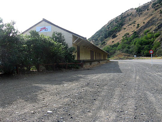
Over 50 accommodation camps were set up. Paekākāriki was the location for three large camps, housing up to 15,000 men of the 1st and 2nd Marine Divisions of the US Marines Corps, and transforming the village of 530 residents. Construction of Camp Paekakariki began on what is now the northern half of the village on 19 May 1942. Camp McKay was built nearby on former Ramaroa Reserve land, and the ‘Rail Air Shed’, a large goods depot for the camps, was built at the Paekākāriki Railway Station.
On 14 June the first US troops arrived at the Paekākāriki camps for six weeks of training, before departing to Guadalcanal. On 4 November 1942 the next groups arrived for a training block. The Paekākāriki camps were expanded in February 1943 with the construction of Camp Russell (in what became Queen Elizabeth Park) to accommodate a large number of returning troops for an extended period of rest and recovery from the gruelling Pacific campaigns. Author Leon Uris published the novel Battle Cry about his time as a Marine at the Paekākāriki camps.
Paekākāriki seemed to the Marines like ‘heaven after hell’, and the locals opened their homes and hearts to the troops. Ngāti Haumia ki Paekākāriki provided much manaakitanga for the soldiers, despite the damage the camps were doing to their whenua. Jean Andrews, daughter of Miriona Budge, recalled letting 30 soldiers use her kitchen on their first night in the camp, their regular use of her laundry, and her enjoyment of the dances, shows and movies at St Peter’s Hall. She also recalled suffering from the racist attitudes of some of the Americans. Ngāti Haumia ki Paekākāriki assisted with the recovery of the bodies of Marines who drowned in a tragic beach-landing training exercise on 20 June 1943.
Aviation Fuel Reserves: the Paekākāriki Fuel Tank Blast Wall
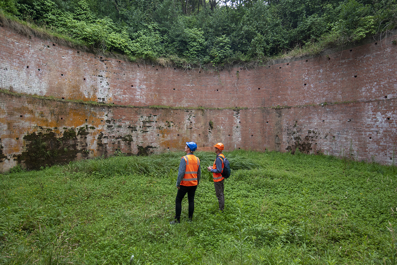
In March 1942 the New Zealand government realised the need for increased storage of aviation fuel, as the US Military planned to station up to 200 aircraft here at bomber bases. 12 fuel depot installations were initially planned, but Paekākāriki was not on the first list of priority sites as it hadn’t yet been chosen as a camp location. However, the construction of what would become Aviation Reserve (AR) 17 at Paekākāriki was ordered in May 1942, after a committee from the Public Works Department, Air Force, Army Camouflage Unit, Railways Department, and Air Secretary’s office had selected the tank’s location. A pre-fabricated 350,000 gallon tank of bolted panels was shipped from the US due to local steel shortages, to be erected in an excavated nook of the Te Puka stream gully that could be covered with camouflage netting (a Japanese reconnaissance plane had been seen over Wellington in March 1942). A steel pipeline would run the fuel to a siding on the railway line opposite the site. Road filling points were also included in the design, disguised at a turning circle laid out ‘in an irregular manner…to give the appearance of an access track to serve the various farm buildings.’ The site was adjacent to the transport depot that served the camps, all of which were within easy walking distance.
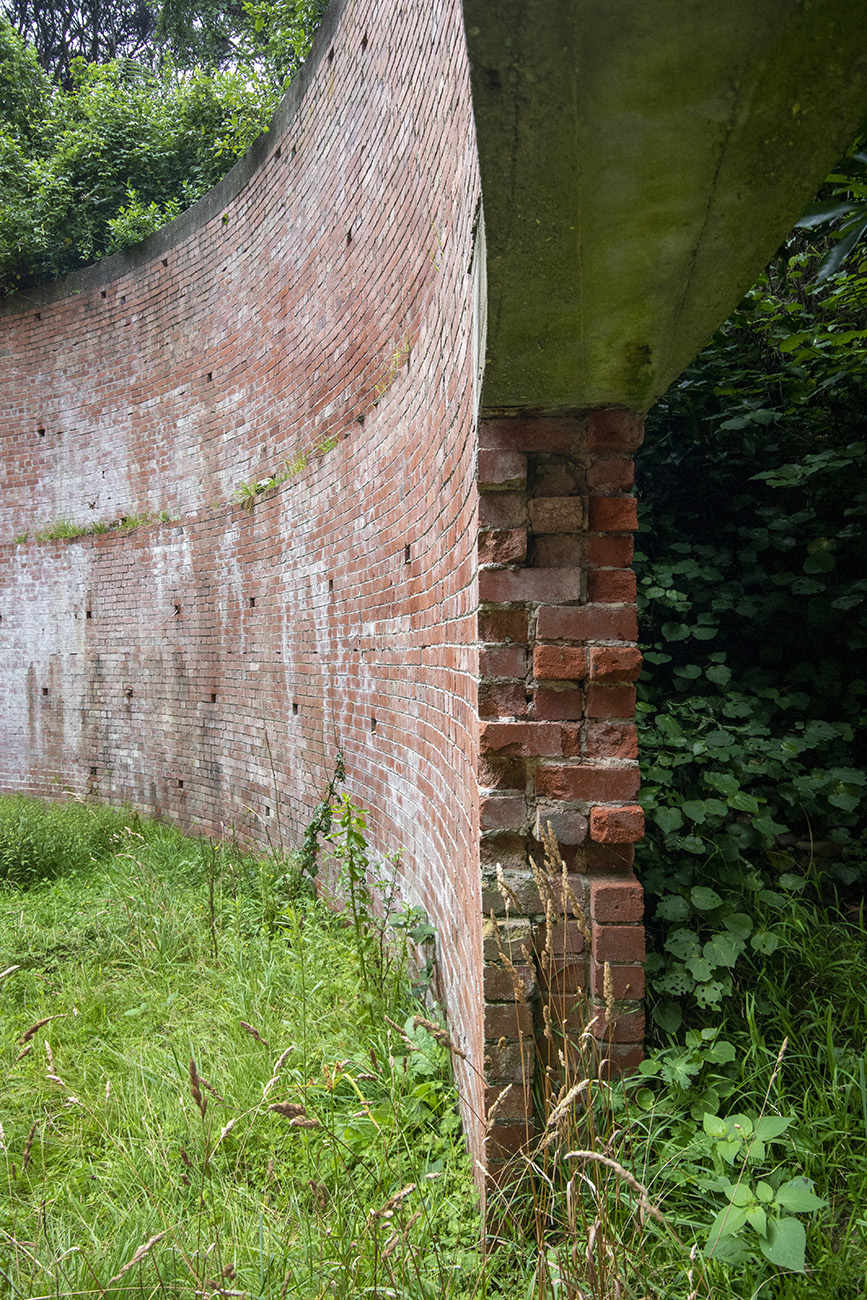
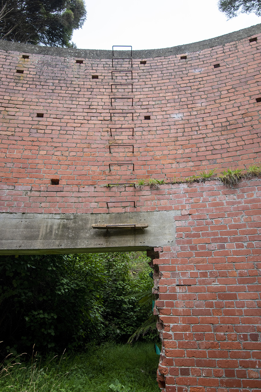
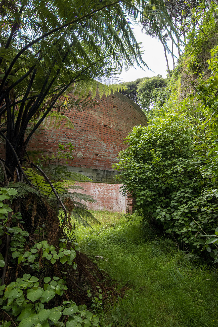
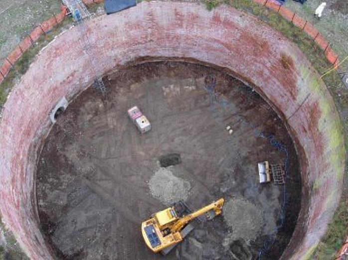
Although urgent, construction of the fuel depot was delayed for a month due to the unavailability of mechanical excavators. Works began in mid-July 1942, but the PWD reported that progress was slow due to the difficult site and waterlogged clay soil. In September 1942, brick walls were added to the designs for all of the AR depots that were receiving bolted tanks. The surrounding ‘splinter-proof’ or ‘blast walls’ would protect the tanks from pressure or piercing from a near-miss from a bomb, and at Paekākāriki, help retain the earth. A gap between the tank and wall would allow for tightening of the tank joints and other maintenance. Love Construction Co., a major national construction firm and predecessor of today’s Naylor Love, was contracted to build the brick blast wall in January 1943 once the PWD had completed the foundations, and they had finished building the wall by mid-March. It included an access cut at ground level to allow the wall to be breached and the tank emptied into the stream in case of emergency.
The construction of the fuel pipeline and the preparation of the tank was happening at the same time. The pipeline required excavation of a 2200-foot (670 metre) trench roughly following the farm access track beside the stream. The welding and joining of the 4-inch steel pipe, which was then sheathed in protective asphalt coating, was done by engineers of the US Marine Corps. The second-hand tank panels, which had arrived from America on the Philae on 30 July 1942, were in such poor condition that they had to be sandblasted and painted before assembly could be considered. Preparation of the panels began in February 1943 but plant trouble meant progress was slow, and by late April only the tank’s base panels were ready to be assembled. However, before assembly could begin, all work on AR17 at Paekākāriki was stopped.
A change of strategy
While the first six months of the Pacific War had caused great concern for Pacific nations as Japan occupied Hong Kong, Singapore and the Philippines, and air-raided Indonesia and Darwin, the US Victory at the Battle of Midway in June 1942 effectively ended the danger of invasion in New Zealand. Subsequent US campaigns at Guadalcanal and Papua further turned the tide. At the end of December 1942 Washington ordered the Aviation Reserve programme in New Zealand be scaled back, with construction of AR5 (Greatford) and AR8 (Wiri) stopped. The order notes that the Paekākāriki installation was, at that stage, to continue, despite it being behind schedule. From February to November 1943 the largest number of US Marines were in residence at the Paekākāriki camps for an extended period of recuperation, and it may have been this factor that allowed the USMC Engineers to speed up progress with their work on the fuel pipeline. However, by April 1943 the US-New Zealand allied strategists had decided that the need for fuel reserves had diminished to the point where any installations not yet completed would be cancelled.
At Paekākāriki, the railway siding had been built; the tank slab base and blast wall were complete but earth battering and backfilling around it was not; the pipeline was laid but not hooked up to the tank; and the tank panels were still being prepared so none had yet been laid or assembled. Orders were therefore given to remove all works including the railway siding, fill in the excavation and return the fuel tank site to its original condition. Sandblasting of the tank panels was the only aspect of the project to be continued before they were packed up and sent to RNZAF Mangaroa, as they would otherwise deteriorate.
The US Marines permanently vacated the Paekākāriki Camps, and left New Zealand, on 1 November 1943 when they were deployed to Tarawa Atoll in Kiribati. The War Assets Realization Board was set up to dispose of surplus buildings and equipment, to ensure redeployment of scarce assets. The camps were dismantled (and 569 of the buildings at Paekākāriki sold for disposal) and the land cleared, ostensibly for return to the people who had owned it before it was seized.
However, Public Works Department officials protested against destroying the tank wall and pipeline, pointing out the considerable money spent on the project, and, as the pipeline had never been used for fuel, the suitability of the site for use as a water reservoir. This use was duly explored, and the Hutt County Council then the Railways Department were approached about taking it over. However, the Council had recently secured an alternative water supply on Leonard Smith’s neighbouring farm, and the fuel tank site in the Te Puka Stream gully wasn’t conveniently close enough to Paekākāriki Railway Station, so both declined. By 1947 the economics of leaving the installation in situ versus removing it had become clear, and its presence was no doubt added to the list of compensation paid to Harold Smith for wartime use of his land.
After the end of the Second World War in 1945, the Government determined to use most of the land it had taken at Paekākāriki for other purposes. The Smiths were pressured to sell more than 500 acres of the former camp sites. They held onto their Transmission Gully ‘Middle Run’ farmland and it became known as ‘Perkins Farm’ after Harold Smith’s daughter Betty and son-in-law John Perkins took it over in 1970. The former Māori land of the Wainui Reserve was not returned to its original owners, despite Miriona Budge fighting hard for it. Much of Wainui Reserve was developed for residential growth of Paekākāriki, and new streets were named in memory of both the US Marines and the ancestry of Ngāti Haumia ki Paekākāriki. In 1953 the farmland north of the main road was permanently acquired by the Crown for the creation of Queen Elizabeth Park, a 1627-acre recreation reserve stretching between Paekākāriki and Raumati South. The adjacent Whareroa Farm Park was also created on former Ramaroa Reserve land.
John and Betty Perkins continued to farm Middle Run until 2012, when after decades of negotiations the Crown agreed to acquire the entire property for the Transmission Gully motorway, a project that had been mooted for many years. The Fuel Tank Wall was identified as a heritage site that could be affected by the works as it was within the road designation. Conservation of the Fuel Tank Wall was made a condition of the consent.
The US Marines remain important in the history of Paekākāriki and Queen Elizabeth Park, with history books and exhibits continuing to educate people about the time when the district played such a part in the ‘friendly invasion’. Memorial gates were installed at Queen Elizabeth Park in 1962 as a physical marker of the camps, and have since been supplemented by prominent signage and memorials throughout the park and at Whareroa Park. In 2009 the Kapiti US Marines Trust was formed to mark, research and celebrate the US Marines presence in the district. Their informative website shows the connections maintained with many veterans and the US Embassy, who attend annual services of commemoration on Memorial Day. A major event was held for the 70th anniversary in 2012.